The best handheld GPS devices with topo maps make it easier to follow trails, record routes, and navigate beyond dependable cell coverage. The models in this roundup range from simple eTrex navigators to feature-rich GPSMAP units with multi-band positioning, electronic sensors, and satellite messaging.
Use the guide below to compare mapping, durability, battery design, screen controls, and communication features so you can choose a device suited to your routes and outdoor priorities.
Best 10 Handheld Gps Devices with Topo Maps Picks for 2026
Best Satellite Communicator
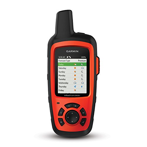
- Two-way satellite messaging and interactive SOS
- Preloaded topo maps with GPS routing
- Up to 30 hours of battery life
Best For: Backcountry users who need navigation and satellite communication
Best for Challenging Terrain
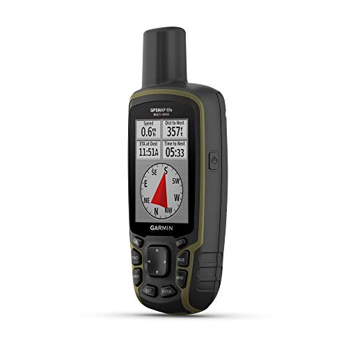
- Multi-band and expanded GNSS support
- Routable TopoActive maps included
- Compass and barometric altimeter
Best For: Outdoor navigation in forests, canyons, and steep terrain
Best Value Navigator

- Routable TopoActive maps included
- GPS and GLONASS satellite support
- Up to 25 hours on two AA batteries
Best For: Hikers and cyclists seeking simple, dependable navigation
Best All-in-One Backcountry Tool
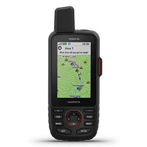
- Topo mapping plus inReach communication
- Birdseye imagery and multi-GNSS support
- Up to 200 hours in Expedition mode
Best For: Remote trips requiring detailed navigation and satellite communication
Reliable Trail Navigator

- Routable TopoActive roads and trails
- 3-axis compass and barometric altimeter
- Up to 25 hours on two AA batteries
Best For: Hikers and cyclists seeking compact topo navigation
High-Accuracy Backcountry Pick

- Multi-band and expanded GNSS support
- Routable topo maps with U.S. public land boundaries
- 2.6-inch sunlight-readable color display
Best For: Users navigating forests, steep terrain, and urban canyons
Long-Battery Explorer

- Up to 1,800 hours in expedition mode
- Multi-GNSS support across five systems
- Garmin Explore app connectivity and IPX7 water resistance
Best For: Extended hikes and camping trips where battery life matters
Rugged Trail Classic

- Preloaded routable TopoActive maps
- Multi-GNSS with compass and altimeter
- Up to 16 hours of GPS battery life
Best For: Button-based hiking, cycling, and hunting navigation
Long-Range Value Pick

- USA Topo maps with 32 GB storage
- Up to 36 hours of battery life
- 3.2-inch screen and IP66 water resistance
Best For: Long outings, hiking, and camping in the USA
Expandable Mapping Essential

- Sunlight-readable 240 x 320 display
- Worldwide basemap and microSD expansion
- Up to 25 hours of battery life
Best For: Compact, expandable outdoor navigation
Best Satellite Communicator – Garmin inReach Explorer+
The Garmin inReach Explorer+ is a strong choice among handheld GPS devices with topo maps when off-grid communication matters as much as navigation. It combines preloaded DeLorme topographic maps, on-screen GPS routing, location sharing, and two-way satellite messaging, though messaging and SOS features require a satellite subscription.
Best For: Backcountry travelers who want navigation plus two-way satellite communication and emergency support.
Pros:
- Two-way messaging and interactive SOS support through the global Iridium satellite network
- Preloaded topo maps with on-screen GPS routing
- Built-in digital compass, barometric altimeter, and accelerometer
- Up to 30 hours of battery life and IPX7 water resistance
Cons:
- Satellite messaging and SOS require a subscription
- Small 2.3-inch display
- Uses buttons rather than a touchscreen for device control
Choose the Explorer+ if communication and safety features are central to your trips. Its topo mapping and navigation tools are useful, but the subscription requirement adds an ongoing cost.
Best for Challenging Terrain – Garmin GPSMAP 65s
The Garmin GPSMAP 65s is one of the more capable handheld GPS devices with topo maps for areas where satellite reception can be difficult. Its multi-band technology and expanded GNSS support are designed for forests, steep terrain, and urban canyons, while the included TopoActive mapping supports routable navigation.
Best For: Hikers, hunters, and campers who prioritize positioning accuracy and physical navigation controls.
Pros:
- Multi-band technology and expanded GNSS support for challenging environments
- Preloaded routable TopoActive maps and U.S. federal public land boundaries
- 3-axis compass and barometric altimeter
- 2.6-inch sunlight-readable color display
Cons:
- Battery life is rated at up to 16 hours
- Smartphone is required for Garmin Explore app compatibility
- Resistive display and button-based operation may feel less modern
The GPSMAP 65s is a practical pick when reception reliability and map-based field navigation matter more than satellite messaging. Its ABC sensors and rugged button operation add useful redundancy outdoors.
Best Value Navigator – Garmin eTrex 22x
The Garmin eTrex 22x is a straightforward option among handheld GPS devices with topo maps for hiking, cycling, and general outdoor navigation. It includes a sunlight-readable 2.2-inch color display, routable TopoActive maps, GPS and GLONASS support, and expandable storage through a microSD card slot.
Best For: Hikers and cyclists who want a simple, battery-powered GPS navigator with included topographic mapping.
Pros:
- Preloaded TopoActive maps with routable roads and trails
- GPS and GLONASS support for tracking in challenging environments
- 8 GB of internal memory plus a microSD card slot
- Up to 25 hours of battery life from two AA batteries
Cons:
- Smaller 2.2-inch display
- No touchscreen
- Does not include satellite messaging or SOS communication
The eTrex 22x makes sense for buyers who want core mapping and navigation without the added complexity of a satellite communicator. Replaceable AA batteries can also be convenient for longer trips away from outlets.
Best All-in-One Backcountry Tool – Garmin GPSMAP 66i
The Garmin GPSMAP 66i combines topographic navigation with inReach satellite communication, making it a comprehensive choice among handheld GPS devices with topo maps. It includes a large 3-inch display, preloaded Garmin TOPO mapping, Birdseye satellite imagery downloads, two-way messaging, interactive SOS, and multiple GNSS support.
Best For: Serious backcountry users who want detailed mapping, satellite communication, weather access, and trip tracking in one device.
Pros:
- Two-way messaging and interactive SOS through the global Iridium network
- Preloaded TOPO maps and direct-to-device Birdseye imagery downloads
- Large 3-inch sunlight-readable color display
- Up to 35 hours in tracking mode or 200 hours in Expedition mode
Cons:
- Satellite messaging and SOS require a subscription
- More features may be unnecessary for basic navigation
- Cellular access is needed for active weather features
The GPSMAP 66i is the most feature-rich option in this group for remote trips. It is especially compelling when navigation, communication, imagery, and extended expedition tracking need to be handled by one handheld unit.
Reliable Trail Navigator – Garmin eTrex 32x
The Garmin eTrex 32x is a practical choice among handheld GPS devices with topo maps for hikers and cyclists who want a compact, rugged navigator with routable trails and roads. Its sunlight-readable color display, GPS and GLONASS support, and 8 GB of storage make it useful for everyday outdoor navigation.
Best For: Hikers and cyclists who want preloaded topo mapping, a compass, and long battery life in a compact device.
Pros:
- Preloaded TopoActive maps include routable roads and trails.
- GPS and GLONASS support can improve tracking in challenging environments.
- Includes a 3-axis compass and barometric altimeter.
- Runs for up to 25 hours on two AA batteries.
Cons:
- The 2.2-inch display is smaller than the screen on the GPSMAP 65.
- Its listed resolution is 240 x 320 pixels.
- Wireless connectivity is listed as ANT+, rather than Bluetooth.
The eTrex 32x emphasizes dependable core navigation over smartphone-style features. It is a sensible pick when preloaded topo maps, physical portability, and a compass-altimeter combination matter most.
High-Accuracy Backcountry Pick – Garmin GPSMAP 65
For demanding conditions, the Garmin GPSMAP 65 stands out among handheld GPS devices with topo maps thanks to multi-band technology and expanded GNSS support. Its larger 2.6-inch color display, routable TopoActive mapping, and public land boundaries are useful for navigating forests, steep terrain, and urban canyons.
Best For: Hikers, hunters, and campers who prioritize positioning accuracy and expanded satellite support in difficult environments.
Pros:
- Multi-band technology and expanded GNSS support are designed for challenging locations.
- Includes routable TopoActive mapping and U.S. federal public land boundaries.
- The 2.6-inch sunlight-readable color display is easy to view.
- Works with the Garmin Explore app and website for managing tracks, routes, and waypoints.
Cons:
- Battery life is listed at up to 16 hours, shorter than the eTrex 32x.
- Navigation uses push buttons rather than a touchscreen.
- The federal public land map is specified for the U.S. only.
The GPSMAP 65 is the stronger technical choice when signal reliability is more important than maximum battery endurance. Its mapping and Explore compatibility also make it well suited to users who review and manage trips after leaving the trail.
Long-Battery Explorer – Garmin eTrex SE
The Garmin eTrex SE is a strong option among handheld GPS devices with topo maps for trips where battery longevity is a priority. It combines a sunlight-readable high-resolution display, multi-GNSS support, a digital compass, and Garmin Explore connectivity in a water-resistant button-operated design.
Best For: Campers and hikers who want exceptionally long battery life, wireless trip tools, and multi-GNSS tracking.
Pros:
- Provides up to 168 hours in standard mode or 1,800 hours in expedition mode.
- Supports GPS, GLONASS, Galileo, BeiDou, and QZSS satellite systems.
- Pairs with Garmin Explore for software updates, trip planning, weather, and notifications.
- IPX7 water resistance supports use in wet conditions.
Cons:
- Two field-replaceable AA batteries are required and are not included.
- The supplied details do not specify preloaded routable topo maps.
- Its listed internal memory is 28 MB.
The eTrex SE is best viewed as an endurance-focused navigator with connected mapping support rather than a traditional high-storage mapping unit. Its standout battery figures and broad satellite compatibility make it especially appealing for extended outings.
Rugged Trail Classic – Garmin GPSMAP 64sx
The Garmin GPSMAP 64sx is a dependable choice among handheld gps devices with topo maps for hikers, cyclists, and hunters who prefer physical buttons and a rugged build. Its preloaded TopoActive maps, multi-GNSS reception, and traditional navigation sensors make it well suited to varied outdoor conditions.
Best For: Hikers and cyclists who want button-based navigation, a compass, altimeter, and routable TopoActive maps.
Pros:
- Preloaded TopoActive maps include routable roads and trails for cycling and hiking in the U.S. and Australia.
- Quad-helix antenna and GPS, GLONASS, and Galileo support help provide reliable positioning.
- Rugged, water-resistant design, sunlight-readable display, 3-axis compass, and barometric altimeter.
- Bluetooth and ANT+ connectivity, with up to 16 hours of GPS-mode battery life.
Cons:
- The 2.6-inch, 160 x 240 display is relatively small and low-resolution by current standards.
- Preloaded TopoActive map coverage is limited to the U.S. and Australia.
The GPSMAP 64sx favors proven, glove-friendly controls and outdoor durability over a large touchscreen. It is a strong fit if you value physical navigation controls and expandable mapping.
Long-Range Value Pick – NiesahYan Handheld GPS
For shoppers comparing handheld gps devices with topo maps, this compact NiesahYan navigator stands out with a large battery claim, a 3.2-inch sunlight-readable screen, and preloaded USA Topo maps. Its physical controls, IP66 water resistance, and multiple satellite systems are practical for hiking and camping.
Best For: Outdoor users seeking long battery life, USA topo mapping, and a non-touchscreen device with simple button controls.
Pros:
- Preloaded USA Topo maps and 32 GB of internal memory support map downloads.
- Up to 36 hours of rechargeable battery life with convenient USB-C charging.
- GPS, Galileo, BeiDou, and QZSS support, plus a 3-axis compass and barometric altimeter.
- 3.2-inch sunlight-readable display and IP66 water-resistant design.
Cons:
- It uses a non-touchscreen interface, which may feel less convenient for map interaction.
- The supplied notes do not specify wireless connectivity beyond USB.
This model is appealing when endurance and included U.S. mapping matter more than a familiar premium brand. Its compact design and physical buttons also suit users navigating in bright or wet conditions.
Expandable Mapping Essential – Garmin eTrex 20x
The Garmin eTrex 20x is a compact option for buyers who want handheld gps devices with topo maps and expandable storage. Its sunlight-readable color screen, worldwide basemap, microSD slot, and GPS/GLONASS reception make it a practical entry point for outdoor navigation.
Best For: Budget-conscious hikers and outdoor users who want a small Garmin unit with room to add maps.
Pros:
- 2.2-inch 65K-color display offers 240 x 320 resolution and sunlight readability.
- Worldwide shaded-relief basemap is included, with support for additional map products.
- MicroSD expansion allows loading options such as TOPO 24K, HuntView, and City Navigator NT.
- High-sensitivity WAAS-enabled GPS, HotFix prediction, and GLONASS support help maintain a position.
Cons:
- The supplied notes do not indicate that detailed topo maps are preloaded.
- Its smaller display may be less convenient for viewing complex map areas.
- Some mapping options, such as BirdsEye Satellite Imagery, require a subscription.
The eTrex 20x makes the most sense for users comfortable adding maps as needed. It offers a compact, straightforward platform with useful storage expansion and a stated battery life of up to 25 hours.
How We Picked These Handheld Gps Devices with Topo Maps
We focused on handheld navigators that combine dedicated GPS hardware with preloaded or compatible topographic mapping. The selection includes models with different control styles, satellite capabilities, screen sizes, sensors, and price points. We also considered practical outdoor details such as water resistance, battery options, sunlight readability, route planning, and ease of use with gloves.
Because “topo maps” can mean different things by model, check the included coverage and available map updates before buying. Some units offer broad preloaded mapping, while others may require additional map downloads, subscriptions, or a connected smartphone for expanded planning.
Quick Comparison
| Feature | What to look for |
|---|---|
| Navigation | Reliable satellite reception, waypoint support, route recording, and trackback tools |
| Mapping | Preloaded topo coverage, map detail, update options, and storage capacity |
| Controls | Buttons for dependable operation in rain, cold, or while wearing gloves |
| Sensors | Altimeter and compass for elevation awareness and directional guidance |
| Communication | Satellite messaging and SOS capability on compatible inReach models |
Key Buying Factors for Handheld Gps Devices with Topo Maps
Mapping and Position Accuracy
Choose a device with map coverage that matches your region and activities. Multi-band receivers and expanded satellite support can improve positioning in forests, canyons, and areas with reflected signals, although real-world performance varies by environment.
Battery and Power
Compare expected runtime, battery type, and charging options. Replaceable AA batteries are useful for extended trips when outlets are unavailable, while rechargeable designs can be more convenient for regular day hikes. Satellite communication generally uses more power than navigation alone.
Screen and Controls
A larger color display can make maps easier to read, but it may increase size and power use. Button-operated units are often preferable in wet or cold conditions because they remain practical with gloves and do not depend on precise touchscreen input.
Durability and Sensors
Look for a rugged, water-resistant housing and a readable screen in direct sunlight. An electronic compass and barometric altimeter are useful for orientation and elevation changes, particularly when the device is stationary or satellite reception is temporarily limited.
Who Should Buy Which Handheld Gps Devices with Topo Maps?
- For basic hiking navigation: An eTrex model is a sensible choice when you want compact route tracking and dependable GPS without advanced communication features.
- For challenging terrain: Consider a GPSMAP 65 or 65s if improved satellite support, rugged button controls, and optional sensor features matter most.
- For mapping and sensors: A GPSMAP 64sx or similar sensor-equipped navigator suits hikers who want topo mapping, an altimeter, and compass in one device.
- For emergency communication: The inReach Explorer+ or GPSMAP 66i is better suited to remote travel where two-way satellite messaging and SOS access are priorities.
- For occasional or budget-conscious use: A simpler older-generation navigator can cover essential waypoint and track functions, provided its map support and battery condition meet your needs.
Before purchasing, confirm the exact model number, included maps, subscription requirements, battery configuration, and regional availability. Those details can have a greater impact on long-term usefulness than screen size alone.